Part I: A thru I


This document contains explanatory notes and background information on various authors and cartographers cited in the Bibliographies and Table. Each Bibliography, Maps or other button is a link to the appropriate bibliographic or other citation.
 A Note about Special symbols & Links
Symbols:  icon in an entry below indicates that entry contains links to Google Earth views of places named in the text.
As Google Earth views are no longer accessible from links in web pages, the KML files that hold this information must be opened in the Google Earth application. To facilitate this process a special access tool is offered here as KMLDownloader.
Admiralty


Beagle Logs:
1835: The September 15 - October 21 section of each Log contains the Galápagos segment of the voyage of the Beagle. See FitzRoy, 1835 to view Galápagos chart and entries in these logs.
Admiralty Charts & Detail views:
1837: All six charts and eight detail views are stamped “Hydrog: Office 10 MY 37” [May 1837] to indicate the date they were received at that office. They are believed to be the source of the single Admiralty chart published in 1841. See Sulloway 1987 for a reproduction of the Beagle track seen on the six charts (but not on the 1841 chart), and Woram 2002b for more details.
L952 Detail View: A small (about 3 × 4¾ inches) inset is pasted diagonally onto this chart. This may be the only extant sample of an original sketch drawn on the Beagle while it was in Galápagos.
South America Pilot Logs:
See Part 3 (Notes: Island Names) for details about the origin of the name “Baltra.”
Elizabeth Cary Agassiz
The author wrote several feature articles for The Atlantic Monthly about the Hassler Expedition of 1872, in which she accompanied her husband Louis (1807-1873). Her Cruise through the Galapagos concludes with a brief mention of Charles Darwin, with observations that suggest she may not have entirely agreed with the views of her creationist husband.
Agassiz was married twice:
- Cecile Braun, d. 1848, mother of Alexander, first president of Radcliffe College.
- Elizabeth Cabot Cary, m. 1850, step-mother of Alexander.
Antonio de Alcedo
On pp. 96-97 of Volume II, Alcedo writes of the island names that “… las mayores son Mascarin, del Tabaco, del Diablo, de la Salud, de San Barnabá y de Santiago. … El capitán inglés Cowley les puso otros nombres a su arbitrio,§ llamando a la primera, Carlos; la segunda, Crosman [sic]; la tercera, Bindlos; la cuarta, Eures; la quinta, York; la sexta, Norfolk.” Alcedo's names are listed alphabetically below, each followed by Cowley's equivalent name (according to Alcedo).
Alcedo may have meant to associate Santiago with York/James (and therefore, San Barnabá with Norfolk). However, since the Spanish Santiago is presumably a mistaken derivation from the English James,—ie, Saint James instead of King James—it would appear that the latter name is the earlier of the two. Perhaps Alcedo avoided this internal contradiction by citing York instead of James. (Cowley had named the island Duke of York's, then changed it to King James when the Duke became King James II.)
Robert C. Allan
The author's Remarks pertained to the visit of HMS Conway in 1834-35. The ship was under the command of Henry Eden, and the author's position or rank is unknown. After Galápagos, the Conway stopped in Lima, Peru on its return voyage to England, as noted by this excerpt from Charles Darwin's 12 August letter to John Stevens Henslow
I sent by HMS Conway two large boxes of Specimens. The Conway sailed the latter end of June.—With them were letters for you.
Joseph Allen
The 1851, 1853 and 1855 editions of Allen's General Record … are included here as the only known publications that furnish some details about Midshipman (and later, Mate & Lieutenant) G. W. P. Edwardes.
David Anderson
In an e-mail message dated 15 May, 2002, David Anderson reports that a small un-named island on the south side of Isla Española has been referred to by his scientific group as Isla Sharon (his wife's name) for the past 18 years. The island coordinates are 1° 24' S, 89° 39' W, which suggests the island is “el Trompo” (Snell 1996; 1° 24' 22'' S, 89° 38' 38'' W).
F. A. Anderson
Page numbers below refer to map locations in Perry Newberry's Castaway Island.
p. 95. Anderson's “Map of The Island” bears little or no resemblance to the actual Isla Santa María (Floreana), despite Newberry's claim (p. 7) that “The map at page 95 is, in its general outline and main details, based upon late surveys of Charles Island.”
p. 300. The map identified here as “Hugh Liborges' Map of the Galapagos Islands” is actually an 1816 revision by James Burney of a 1699 map by Herman Moll.
Anonymous
The chart is briefly described in Report of the Librarian of Congress for the Fiscal Year Ending June 30, 1929. In dating it, the Report states (p. 135) that “It appears likely that it was not made until after the year 1561, because it contains the place name Landecho for a village in Guatemala.§ This village seems to have been named for a president of the Audiencia of Guatemala, named Landecho, who assumed office in 1561.”
The chart was a gift of Edward S. Harkness to the Library of Congress. Nothing further is known about it.
Aaron Arrowsmith
Four versions of the Arrowsmith chart display a date of 1st January 1798. However, minor differences in the printed publisher's address and other details suggest that subsequent versions were produced after this date, as summarized here.
| Presumed Dates for Aaron Arrowsmith's Galápagos Charts |
| Date | Publication Details on Chart | Address on Chart | Dates at this Address |
| 1798 | Published 1st January 1798. by A: Arrowsmith
(Same information printed on each chart, except 1817.) | Charles Street, Soho. | 1794-1799 |
| 1805 | Rathbone Place. | 1799-1808 |
| 1808 | 10 Soho Square. | 1808-1823 |
|
1817 | (no information on this chart) | (no address given) |
| 1820 | Published 1st January 1798. by A: Arrowsmith | 10 Soho Square. ______ Hydrographer to His Majesty. |
| Note: Dates are approximate, based on address and/or other details on each chart. |
1798 [1st edition]. This chart appears in James Colnett's A Voyage to the South Atlantic and Round Cape Horn into the Pacific Ocean and is assumed here to be the first in the series. Charles Isle is labeled but its outline is incomplete, and the ship's track makes it clear that Colnett did not visit this island. Brattle Isle is due South of Cape Woodford (on Isabela), and Crossman is due East of Brattle. Jervis, Duncan and Barrington are present and complete, while Norfolk is just a very small fragment. Dalrymple Rock is shown, although this name does not appear in Colnett's text.
1805 [2nd edition]. Same as the previous edition, except Arrowsmith's address is given as Rathbone Place. Other Arrowsmith maps showing this address (often, 24 Rathbone Place) are dated in the early 1800s.
1808 [3rd edition]. Arrowsmith's address is given as 10 Soho Square. He moved to this location in 1808. The outline of Charles Isle remains incomplete, but “Careening Place. Water and plenty of Wood” is added at the North end. Soundings of 6, 7, 8 (fathoms) appear in the Post Office Bay area, although this name does not yet appear on the chart. According to
Burney (p. 204), Arrowsmith added these details based on information from another [unidentified] source. Colnett himself did not visit this general area, nor did he stop anywhere else on Charles Isle (the modern Isla Floreana).
1817 [draft]. The format resembles the other Arrowsmith charts, with publisher and date omitted, presumably because this was an unpublished preliminary draft for the subsequent 1820 edition. A hand-written title appears at upper right, in place of the printed cartouche on the published versions of the chart. In addition, a hand-written “ D9092, Shelf Pt*” appears near the lower right corner.
The 1817 date assigned here is based on the notation “Additions & Corrections to 1817” found on the 1820 edition. The chart does not show the track of the ship. All others do. New island details are summarized here, and unless otherwise noted are presumably based on an 1815 chart by John Fyffe, captain of HMS Indefatigable.
| Dower's I. | This island—presumably the present Isla Genovesa (Tower)—does not appear on the previous three editions of this chart. Its shape and location agree with the Dowers island on Fyffe's chart. |
| Erasmus | Southeast of Brattle, and quite close to Cape Woodford. Jervis and Duncan are omitted, and Crossman's I. is now in the approximate position of Duncan on the 1798 edition. |
| Herdar's Rocks | A triangular arrangement of rocks, due North of Champion I. |
| Indefatigable | The previous S. E. fragment of Norfolk is replaced by a complete rectangular-shaped
Indefatigable, which closely resembles Porter's Isle on Fyffe's 1815 chart. Since Fyffe did not rename the island after his own ship (HMS Indefatigable), the name change may have been the work of Arrowsmith when he prepared this edition. |
| Post Office | This label, which is also seen on the Fyffe chart, is added to Charles' Isle. |
1820 [4th (final) edition]. The chart appears to be a final version of the 1817 draft chart, and the new island details described above are repeated on this edition. Also dated 1798, but the cartouche includes “Additions & Corrections to 1817” and the title adds “Hydrographer to His Majesty.” Arrowsmith was appointed Hydrographer in 1820.
Summary
As noted above, the new names on the 1817 chart seem to be derived from the 1815 Fyffe chart. These names and similar island shapes subsequently appear on an 1827 Vandermaelen chart. For example, compare Porters Isle (Fyffe 1815), Indefatigable (Arrowsmith 1817) and Ile Infatigable [sic] (Vandermaelen 1827).
| Island Names on Arrowsmith Charts |
| 1798, 1805, 1808 | 1817 | 1820 |
|---|
| Abington Isle | Abington Isld | Abington Isle |
| Albanie I. | (name omitted) | Albanie I. |
| Albemarle Isle |
| Barrington Isle | Barrington Id | Barrington Isle |
| Bindloes Isle | Bindloes I. | Bindloes Isle |
| Brattle Isle | Brattle Id | Brattle Isle |
| Caldwell I. |
| Champion I. |
| Charles Isle |
| Lord Chatham's Isle | Lord Chathams Isle | Lord Chatham's Isle |
| Cowly's enchanted Isle | Cowleys Enchanted Isle | Cowly's enchanted Isle |
| Crossmans Isle | Crossmans Id | Crossmans Isle |
| Culpepers I. | Culpepper's Isld. | Culpepers I. |
| (not present) | Dowers' Id | Dowers' I. |
| Duncan Isle | (name omitted) | Duncan Isle |
| Enderby's I. |
| (not shown) | Erasmus Id. | Erasmus I. |
| Gardner I. | Gardiners I. | Gardner I. |
| (not shown) | Herdar's Rocks |
| Hoods Isle |
| James Isle |
| Jervis Isle | (name omitted) |
| McGowen's Reef |
| Narborough Isle |
| Norfolk Isle | Indefatigable I. | Indefatigable I. |
| Norrie's Rocks |
| Rodondo Rock |
| Watson's I. |
| Wenams I. | Wenam's Id. | Wenams I. |
| (not present) | Possible White Rock | (not present) |
bold: First appearance of this name,
italic: Island moved from previous position,
bold italic: Island moved and renamed.
|
Associated Press

The 1934 photo is of the highland caves on Isla Floreana, which at the time may have been occupied by J. F. Schimpff (Ritter and Dore Strauch lived elsewhere on the island). In any case, the photo was certainly not found on the body of Rudolph Lorenz. Under a headline of “Ecuador fears Nazis eye her Galapagos Islands”, the text on the back of another photo (not seen here) makes the presposterous claim that “Dispatches from Quito, Ecuador, suggested that Germans who reside on her Galapagos Islands, 1,000 miles southeast [sic, southwest] of the Panama Canal, may demand the annexation of the strategic group by Germany.” The “Dispatches” are unidentified. So far, no newspaper has been found that actually printed these photos.
Audubon Association
The paragraph below in the August 1928 issue of the Association's bulletin The Gull gives the dates for the Oaxaca visit to Galápagos:
Proceedings of the July Meeting. Mr. Slevin reported on observations made … on the occasion of the visit of the “Oaxaca,” Captain G. Alan Hancock, last November and December.
Joseph Baker
Joseph Baker is listed as Lieutenant (3rd in 1790, 2nd in 1792, 1st in 1794), and was responsible for the compilation of charts on the voyage of HMS Discovery. See also James Johnstone.
George Hugh Banning
Banning was on the 2nd Hancock Expedition, December 29, 1932-March 23, 1933, which was in Galápagos January 24-February 26, 1933, hence known as the 1933 expedtion.
Nora Barlow
p. 333: September 16th: “The next day we ran near Hood's Isd & there left the (“a” in Keynes) Whale boat.” Compare with
FitzRoy.
p. 338: September 28th: “Steered towards the Southern end of Albemarle Isd, which was surveyed.” Barlow corrects Darwin's misspelling [“Albermale” as cited in Keynes] without comment.
William Beebe
Williams Galápagos Expedition.
p. 2: A sketch map shows Wheeler Rock east of Isla Daphne Major.
p. 17: “At Panama we added to our party Prof. William Morton Wheeler of the Bussey Institution, Harvard.”
Galápagos: World's End.
p. 257: “To distinguish them [the two Daphnes] I dubbed them Daphne Major and Minor.”
The Arcturus Adventure: An Account of the New York Zoological Society's First Oceanographic Expedition.
p. 427: “Osborn Island, in honor of Prof. Henry Fairfield Osborn, is the name I have given to the larger of two islands lying between Hood and Gardner.”
Evremond de Bérard
| 1875: Collins & Son Around the World |
|---|
| Title | Illustrator * | Page | | Title | Illustrator * | Page |
|---|
| Chatham Island † | Sargent | 505 | Watering-Place, Charles Island † ‡ | Gauchard | 512 |
| Charles Island † | Sargent | 506 | Birds, Reptiles, and Vegetation [2] | Huyot | 513 |
| Post-Office Bay, Charles or Floriana Island [1] | Sargent | 510 | |
| ca. 1880: In unknown books |
|---|
| Albemarle Island † | J. Huyot | (unknown) | in English book. Possibly, a later edition of Around the World. |
Archipiélago de Galápagos ―
Aguada de la Isla Cárlos † ‡ | J. Gauchard | (unknown) | in Spanish book. Apparently a copy of Gauchard/de Berard work above, but with Spanish caption. |
* Illustrator's name at lower left, engraver's name (de Bérard) at lower right.
† Engraving based on S. Bull engraving of Philip Gidley King's original drawing in FitzRoy's Narrative … (vol. 2, p. 498).
‡ Both are actually Chatham Island (ie, Isla San Cristóbal).
[1] Illustrator's name at lower center, indistinct initial (probably “B” for de Bérard) at lower left.
[2] “Rouye” at lower left; “Huyot” at lower right (customary illustrator/engraver locations apparently reversed). Source unknown, pending further research. |
Nathaniel H. Bishop
p. 247: “The first land made … was the rock of Dunda.”
p. 247: “We steered for an uninhabited island of the Galápagos, called
Terrapin Island.”
Juan Black
p. 9: “Los navegantes españoles, entre 1546 y 1560, las conocían como
Las Encantadas, por la difficultad de hallarlas. Cabello Balboa las menciona come
Las Huérfanas, en 1584. En el Acta de Toma de Posesión, 1832, el Coronel Ignacio Hernández le denominó
Archipiélago del Ecuador. Desde el 18 de febrero de 1973 el archipiélago vuelve a ser provincia, con el nombre de
Provincia de Galápagos.”
Rolf Blomberg
Blomberg was a popular Swedish author who described his visit to Galápagos in his first book. Included is a photo of Anita Johnson, widow of “Johnson from London” (Captain Thomas Levick).
José A. Bognoly & José Moisés Espinosa
p. 48: The authors identify the captain of a vessel as “capitán Tomás Levick, jefe de una embarcación menor de propriedad del señor Valdizán.” A captain Levick is mentioned by Hunter but his first name is not given.
Peter T. Bradley
The author's Last Buccaneers … is a 37-page summary of Massertie's Journal, followed by the French original (pp. 40-79) and various related Spanish documents (pp. 82-101), none of which are translated into English. In a p. 17 footnote, the author notes that in a few cases he was able to “correlate the journal's French names [of islands] with those in Spanish sources.” In his subsequent text, the following names (in French/Spanish) are noted below. Although no correlations with modern names can be easily made, the names on pp. 18-19 suggest two possibilities.
- p. 18: Île Brûlé/Santa Teresa
- p. 19: Mascarin/Nuestra Señora & Notre Dame/Santo Tomás
- p. 23: Île Verte/(no Spanish equivalent)
- p. 28: St. Bernard/(no Spanish equivalent)
Bradley states (p. 18) that Massertie described his arrival at an island “20 leagues [about 60 miles] long, below the equator and with a large bay” which he named Île Brulée [sic, Brûlé] (Burnt Isle). The length may have been his rough estimate of the modern Isla Isabela, as seen from its north end, which is indeed “below the equator.” In any case, all other islands are less than half that length.
Later (p. 19), Massertie arrived at “Mascarin Isle” and then sailed to “ ‘the other rendezvous’ of their first visit, now named Notre Dame 18 leagues [54 miles] away.” The “now named Notre Dame” is unclear, since there is no island now with that name. Assuming that the place of their first visit—Île Brûlé—is the modern Isabela, then Mascarin is probably the modern Isla San Salvador, whose northeasterly coast is about 54 miles from Isabela.
See the Massertie notes for more details about his Journal.
A. Brosset
p. 104: Footnote 7 (p. 80) in Lanza 1982 states that Caamaño is named “Johnson by Brosset.”
Kenneth Brower (ed.)
Volume 1, section 1: Corsairs. The quotations attributed to Edward Davis are in fact taken from the journal of William Ambrosia Cowley, presumably Sloane Ms. 1050. Those attributed to Salvator R. Tarnmoor are from The Encantadas by Herman Melville.
Volume 1, section 2: Sailors. This section contains additional excerpts from The Encantadas and here Herman Melville is identified as the author. There is no explanation why the Section 1 excerpt from the same work is attributed to Melville's “Tarnmoor” pseudonym.
The author of the pages attributed to “C. T. H.” (no other identification given) is Caspar Thomas Hopkins.
William F. Buckley, Jr.
p. 79: Chart shows Marcheria at location of Isla Marchena.
Bureau of American Republics
p. 47: “The favored ones were called 'Mascarín,' 'Tabaco,' 'Diablo,' 'Salud,' 'San Bernardo,' and 'Santiago.' These names were changed by Capt. Cowley. Mascarín was called
'St. Charles;' Tabaco, 'Crossman;' Diablo, 'Bindloe;' Salud, 'Eures;' San Bernardo, 'York;' and Santiago, 'Norfolk.' ”
p. 48: “[Other islands] … are named …
Bindolese, …
Carlos (now Floreana) … and Isla
Anónima, or unnamed island.”
Given the similarity to the six island pairings of
Alcedo, including the incorrect Santiago/Norfolk association, it would appear that the unidentified author copied that information, then introduced additional errors (Cowley's Charles becomes St. Charles, Alcedo's San Barnabá becomes San Bernardo).
James Burney
William Hacke (or Hack)
In Volume 3, Chapter XIII, p. 317, Burney refers to “… a small collection of Voyages edited by Captain William Hacke … .”
In Volume 4, Part I, Chapter XII, p. 138, he refers to “The Editor of Cowley's Journal, William Hack, … ” and on the next page, “Hack embellished this account … .”
Burney's alternate spelling of “Hack” in Volume 4 may be the source of later citations that use this spelling. Note also that Burney twice refers to Hacke/Hack as the editor of the voyages, which were in fact published by James Knapton. See also William Hacke citation below.
On the identity of Charles Island, in Volume 4, Part I, Chapter XVII
Map facing page 145: John Russell (Burney's engraver) revised the Moll map in Hacke's Collection of Original Voyages to show Isla Sta. María, according to Burney's explanation given on p. 204.§ The map title is also changed from “The Gallapagos Islands Discovered by Capt. John Eaton” to “Gallapagos Islands, Described by Ambrose Cowley in 1684.”
Other details on p. 204
“The most Western in the Spanish list published by [Pascoe] Thomas is named Sta. Margarita, and is the same with the Albemarle Island in Cowley's chart.”
“Mr. [Aaron] Arrowsmith has added this harbour to Captain Colnet's [sic] chart, on the authority of information communicated by the master [unidentified] of a South Sea whaler.” This is the present Post Office Bay, which had not yet been given that name.
Other details in Volume 4, Part II, Chapter V, p. 381
“De Villefort says, ‘…we knew it to be the Isle à Tabac.
The Isle de Santé is 20 leagues [away].
The Isla Mascarin [is] in 1°12' South latitude.’ ”
George Anson, Lord Byron
Captain the Right Honorable George Anson, Lord Byron, was commander of HMS Blonde, which transported the bodies of the King and Queen of the Sandwich Islands back to their home, after their deaths of measles while visiting England. Byron became the 7th Lord Byron on the death of his famous cousin, the poet George Gordon Byron, as shown on the accompanying Byron Family chart. Although His Lordship is often credited as the author of the Voyage, the Preface states “The following narrative has been compiled from the various journals and notes made by some of the officers and other gentlemen that accompanied Lord Byron on his interesting voyage to the Sandwich Islands.” In context, it would appear that Lord Byron himself contributed little or nothing to the book.
The unidentified editor was Maria Graham (later, Lady Callcott), who does not further identify her sources. The Blonde stopped off at the Galápagos Islands, where an unknown member of the ship's company described the marine iguanas as “imps of darkness,” a phrase which Darwin used several times in his Diary. Graham does not identify the originator of the phrase, and it does not appear in three of her known sources:
- Andrew Bloxam: The latter's brother Richard Rowland Bloxam was ship's chaplain, and may be the source. However, his own journal (if it survives) has not yet been found.
- Robert Dampier
- James Macrae: not in extracts from his diary published in 1922 as With Lord Byron at the Sandwich Islands
Miguel Cabello Balboa
His name is often seen as Cavello or Valboa. Like Sarmiento de Gamboa, he described the voyage of Tupac Inca to the islands of Avachumbi and Ninachumbi. According to Slevin, “These, Cavello says, may have been two of the Galápagos.” In fact, Cabello wrote:
“I dare not confirm this deed, however, nor determine the islands in question, but the Indians report that the Inca brought back from this expedition a great number of prisoners whose skin was black, much gold and silver, a throne of copper, and skins of animals similar to horses. One is quite ignorant of where in Peru or the ocean washing its coast he could have found such things.”
Camillas & J. W.
The 1847 edition of The Friend contains untitled whaling features by “J. W.” (Vol. V, No. VIII) and “Camillas” (Vol. V, No. X). Since both are sub-titled “A Sailor's Epistle Home” and “Albermarle [sic, Albemarle] Jan. 5, 1847” it is assumed here that “J. W.” and “Camillas” are the same person, as yet unidentified.
Charles C. Carpenter
p. 360: “… a small reef island (Devine's [sic,Divine's] Island) in Academy Bay … (450 × 200 feet).”
p. 360: “Jensen Island lies about one mile off shore at the entrance to Academy Bay.”
(Therefore, Divine's Island is not another name for Jensen/Caamaño. Location on IOA 20302 is 0°45'09'' S, 90°18'22''W.)
Owen Chase
Chase's coverage of Galápagos is quite brief, and makes no mention of the fire started there. He differs from Nickerson in the number of days spent at Hood, and the tortoises caught at both Hood and Charles Islands. Presumably Chase, an adult writing within a year of the incident, is more accurate than Nickerson, who was 14 years old at the time, and who wrote his own account many years later.
Christie, Duncan, et al
p. 246: “The oldest known and best documented of the drowned islands, referred to here as the85°40'W seamount, … . A second large, previously unmapped seamount to the north ofSunray seamount has been named
'Fitzroy' after the captain of HMS Beagle.”
The authors describe several seamounts east of the present islands that originated over various Galápagos hotspots and then were submerged over time. The origin of the name “Sunray” is not given, but is believed to have come from a bathymetric chart jointly published by the Scripps Institution and the Bureau of Fisheries. [Further details to follow if the chart can be located.]
Sam T. Clover
A biography of Captain G. Allan Hancock, the book contains information on Hancock's visit to Galápagos on his Oaxaca and also the first voyage of the Velero III. Regarding the Oaxaca voyage, Clover states (p. 140):
“Carrying a full crew of thirty-five men, there was, in addition, a passenger list of twelve persons.”
In two places (pp. 140-141 & pp. 152-153), he lists eleven of these passengers by name, and presumably he counted Captain Hancock as the twelfth passenger. Dr. Palmer's name is not mentioned at all, which would be unusual if he were in fact also serving as doctor.
The book also contains the following mis-information about the naming of the islands (p. 144):
“Historically, [the islands] date back to the sixteenth century, with the Spaniards as discovers, who honored their saints and sovereigns by naming the six larger islands Isabella [sic, Isabela], Fernandina, Santa Cruz, San Cristobal, San Salvador and Santa Maria, which the English buccaneers, at a later period, rechristened Albemarle, Narborough, Indefatigable, Chatham, James and Charles (or Floreana).”§
Additional mis-information from the author includes (p. 145):
“Then came Rodriguez and Francisco de la Puente,§ who called them Pearl Isles, while still later that great adventurer, Juan Fernandez, named them Paradise Islands.”§§
And finally, some conflicting information about Malpelo:§
p. 149: “Early the following morning the Hancock expedition bade goodbye to the Galapagós [sic, Galápagos] save for a brief halt off Malpelo Island, a barren, basaltic rock about a mile in length.”
pp. 193-194: (First voyage of Velero III): “Malpelo Island, a bare glistening rock two hundred miles from Panama was dead ahead. … From Malpelo the Velero headed straight for the Galapagós … ”
Frederick P. Cole
The bark Vigilant, Frederick P. Cole, was in Galápagos July 2-13, 1860. A July 2 log entry referring to Perrys Isthmus was subsequently mis-read as Perry's Island. See Robert Langdon for details.
William Collins & Son
Of particular interest in the unsigned article in Around The World are five engravings contained within it. See Evremond de Bérard, above for details
The text itself is comprised of edited extracts from the Galápagos accounts of Captain Robert FitzRoy (pp. 499-504) and Charles Darwin (pp. 504-515), but with several errors introduced by the unknown editor:
- p. 499: The captain of HMS Adventure is listed as Captain T. P. Parker. The captain's actual name was Phillip Parker King.
- p. 499: Of the second voyage, “… the Beagle was commissioned by Admiral Fitzroy in July, 1831.” FitzRoy was promoted to Rear Admiral in 1857, some 20 years after the voyage.
- p. 501: A footnote reads: “These islands were sold in 1855 to the United States.”
- p. 501: In FitzRoy's description of the spring on Charles Island, an inserted “(See p. 512.)” note refers to the “Watering-Place, Charles Island” engraving on that page. As noted in the table above, the location is actually Chatham Island.
- p. 504: “In the morning (Oct. 17th) we landed on Chatham Island.” The month was actually September.
James Colnett
p. ix: “Messrs.Enderby and Sons” & xiv: “Messrs.Champion” (but with no reference to naming islands after them).
p. 60: “As I could not trace these isles, by any accounts or maps in my possession, I named one
Chatham Isle, and the other
Hood's Island, after the Lords Chatham and Hood.”
p. 139: “… the Kicker Rock, bearing West.”
p. 141: “Near the West part of the isle [San Cristóbal] in a small bay was a part of the wreck of a ship, …”
p. 142: “… the two largest of which I named after the admirals Sir Alan
Gardner and
Caldwell.”
p. 155: “These three isles now seen, I named after the admirals
Barrington,
Duncan, and
Jarvis.”
Also on p. 60, Colnett writes: “In the accounts of Wood, Rogers [sic,Woodes Rogers] and others, the Spaniards are said to be acquainted with an island in the Latitude of 1° 16' South, which has plenty of water on it.”
NOTE: Colnett was an officer of the Royal Navy, and the Navy's sloop Rattler was to be lent to Enderby and Sons for the purposes of Colnett's voyage. However, it was subsequently determined to sell the ship to the Enderbys and Colnett in turn purchased half the ship from them and obtained a Leave of Absence from the Navy for the duration of the voyage. He was therefore, of the Royal Navy, but not sailing aboard a Royal Navy Vessel. Hence his ship was to be known as the merchant-ship Rattler, not HMS Rattler.
Although Colnett is often credited as the originator of the post office barrel, a detail view of the track of the Rattler on the 1798 Arrowsmith chart published in Colnett's Voyage shows that he did not stop at Charles Island at all, nor does the “Post Office” designation appear on this chart. The term appears for the first time on the Arrowsmith draft chart (ca. 1817) which was drawn more than 20 years after Colnett's visit to Galápagos.
Ainslie & Frances Conway
“What I meant is this,” Ainslie explained to his own satisfaction, not mine. “In this book called Isles of Escape a man named Porter writes:
“The Galápagos have a malign spell which repels all efforts at colonizing … where life is hard and existence precarious. … Very little is known about the Galápagos. … The Galápagos are only for the few; they are not for poor people or for persons with responsibilities. Many people, in fact, if they found themselves in the Galápagos, without proper planning and forethought, would undoubtedly die. And so I warn the readers of this book to remain away from the Islands of Enchantment.”
The ellipses are in the original. With the exception of the final sentence, whose source is unknown, the rest of this passage is excerpted from the Foreword to Isles of Escape, by Sidney
Howard. Apparently the Conways mixed up the names of Sidney Howard, David Porter (also cited in the book), and possibly others: in describing the ship Manuel J. Cobos, the authors write: “… we had seen a photograph of her in Sidney Porter's book.” There is no photograph of this ship in Sidney Howard's book, and of course David Porter's book was written a century earlier.
In her Floreana Adventure, Margret Wittmer refers to Conway as Elmer, which was in fact his first name. However, he is identified only as Ainslee in the two Conway books, both of which were written solely by his wife Frances.
Edward Cooke
In Voyage to the South Sea, volume 1,
Plate 8 shows sketches of
Dukes and
Dutchess Islands. The orientation of a compass rose, together with a small flat island (Baltra) to the north and two tiny rocks (Gordon Rocks) to the east of Dukes Island suggests that it is the present Isla Santa Cruz, and that the nearby Dutchess Island is Santa Fe.
p. 303: “The Island we were at, we call'dMarqueses Island.” The description and accompanying illustration of “One of ye Gallapogos Islands” (Plate 11) suggest this is the present Isla San Cristóbal.
Amory Coolidge
Businessman Amory Coolidge sailed his schooner Blue Dolphin to Galápagos and subsequently typed an unpaginated account, bound in sail cloth from the ship. Only one copy is known to exist. A November 20, 1934 New York Times news report about the disappearance of the Baroness included some details of the ship's visit to Isla Floreana.
Jack Couffer
Chapter 6: “World's End” (pp. 47-64) describes the author's work filming the Walt Disney documentary Islands of the Sea, first on the Highlander and later on the Tropic Bird.
John Coulter, M. D.
Coulter, the ship's surgeon, devotes seven of his 17 chapters to Galápagos. Compare his description of the fate of Patrick Watkins (who Coulter identifies only as “Pat”) with that reported by David Porter and later, Herman Melville.
W. I. B. Crealock
p. 42: “We sailed out of Academy Bay, passed the cluster of rocks called
Seal Island, and followed the coast round the western end of
Indefatigable.”
Thomas de la Cruz Doblado
Positive associations for most island names are uncertain due to the inaccuracy of island positioning.
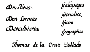 |
Note: The copyist's name is often seen as “Cruz Doblado” elsewhere, although a style comparison of the letters “D” and “G” seen in the 1794 Carta Espherica text suggests it may be “Goblado.” However, “Doblado” is seen here, if only to follow the style found almost everywhere else. |
Donald C. Cutter
Although there are no specific references to Galápagos island names, the text cites various names found on the Galápagos charts of Cruz Doblado.
p. viii: CayetanoValdés is identified as a Nootka expedition officer.
p. 114: “The Frigate Santa Gertrudis (Captain Alonso Torres, …).”
p. 117: The text cites a Spanish settlement “named in honor of Admiral ManuelNúñez Gaona of the Spanish navy.”
William Dampier

“They are laid down in the Longitude of 181, reaching to the Westward as far as 176, therefore their Longitude from England Westward is about 68 [sic] degrees.”
It would appear that Dampier's typesetter had difficulties with this sentence: in order for the first part to make sense, the longitudes must be rewritten as 281 and 276 (measured eastward from England). Having made these changes, we may convert them to 79° west and 84° west, respectively. To these values add 5°13', for Dampier reckoned his longitudes from “The Lizard” (Lizard Point, in Cornwall) rather than from Greenwich. This places the islands between 84°13' W and 89°13' W. The actual values are 89°14' W (east end of Isla San Cristóbal) and 92° W (west end of Isla Darwin) (Lanza 1974, p. 510). So Dampier was correct: 17th-century cartographers had not placed them far enough to the westward. However, he did over-estimate the breadth of the archipelago by a few degrees of longitude.
Of course, the islands could not be 68 degrees removed from England, which would place them somewhere east of Quito. Perhaps this error was introduced by someone else and not caught by Dampier who, one hopes, would have corrected it. Unfortunately, he did not include these cartographic details in his hand-written manuscript (ca. 1695), which is preserved in the Sloane Collection † at the British Library, so there is no place to look for the source of the errors.
† Sloane Ms. 3236. The Adventures of William Dampier with others who Left Capn. Sharpe in the South Seas and travaled [sic] back over Land through the Country of Darien.
Charles Darwin
When the Narrative … was published in 1839, Darwin's contribution comprised Volume III, entitled simply Journal and Remarks. Within the year it proved so popular that it was published separately. Since then it has undergone several title changes, as summarized here.
1839. Journal and Remarks, (Volume III of Narrative …)
1839. Journal of Researches into the geology and natural history of the various countries visited by HMS Beagle. First edition as separate work.
1845. Journal of Researches into the natural history and geology of the countries visited during the voyage of HMS Beagle round the world. Second edition, with “natural history” placed before “geology” and significant revisions to text.
1879. A Naturalist's Voyage. Journal of researches …
1905. Voyage of the Beagle on this and subsequent editions.
The 1851 edition of Geological Observations … is a compilation of two previous works which were out of print at the time:
Part I: Geological Observations on the Volcanic Islands …, together with some brief notices of the Geology of Australia and the Cape of Good Hope. (1844)
Part II: Geological Observations on South America. (1846)
The 1851 edition retained the title of Part I, dropping the … together with … segment, but retaining the chapter on Australia and the Cape of Good Hope. “Galapagos Archipelago” comprises Chapter V in this edition.
Philip Dassigny

Referring to Bartholomew Sharp's Wagoner § of the Great South Sea, Kemp & Lloyd state (1960, p. 59) that William Hack had “… a Jewish friend named Phillip Dassigny, later a shipmate with Cowley, to translate the {Spanish} sailing instructions” in that ms. Later (p. 93), the authors state that Dassigny was “the draughtsman of the South Sea Wagoner” and that Cowley named a small island after him.
Perhaps copying from Kemp & Lloyd, Howse & Thrower (1995, p. 261) cite “… a translation of the sailing directions by Philip Dassigny, a Jew who apparently later sailed in one of the buccaneer ships to the Pacific and after whom Cowley named one of the Galápagos islands.
None of these authors reveal their sources, nor do they explain why Dassigny's religion is mentioned. Furthermore, it is unlikely that Dassigny ever sailed with Cowley. Islands named Bindlos's, Dassigny's and Eures's appear for the first time in “Cowley's Voyage Round the Globe” published in 1699 while Cowley was away. Chances are, the names were added by either William Hacke or Herman Moll, presumably without Cowley's knowledge. See Cowley's Table of Island Names for further details.
As a possible coincidence, Reports of Cases Argued … from 1670 to 1704 lists Case 222 as Turbet against Dassigney (in 1682). The latter is charged with “…unlawfully carrying the plaintiff Turbet to Jamaica [and] was fined five hundred pounds.” Elsewhere, the first name of the defendant is given as Philip. As for the spelling of his last name, Cowley's Table of Island Names (see above link) shows an island labelled Dassigneys Isl. in “Cowley's Voyage Round the Globe” (chart facing p. 9). To conclude, are Philip Dassigny and Philip Dassigney the same person? The evidence, such as it is, suggests the answer may be “yes.”
William M. Davis
p. 101: “In a few days we dropped anchor in the harbor of
Porter Islands, a favored resort of Commodore Porter.”
p. 108: “He [Jim Sellers] now met him [Captain Springer] here at Porter Islands.”
p. 204: “… the singularRondonda,
or Rock ofDunda.” (after Bishop?)
p. 220: “A curious feature of the Galapagos is the novel post-office, established there by Commodore Porter, during the last war with England, while the Essex harbored in the island which bears the name of her worthy captain.
Of course Captain Porter did not establish the Galápagos Post Office barrel, but merely took advantage of it to determine what British ships had been in the area. Also, the island which bore his name [ie, Porter's Island] is the present Isla Santa Cruz, not Santa María where the Post Office barrel was—and still is—located.
Peter Deilmann Cruises
“Bachas Islands are located west of Black Turtle Cove and are a favorite nesting site for Sea Turtles who enjoy its beautiful soft white sand.”
There are no islands in Galápagos with this name. This appears to be a reference to Playa las Bachas, or Las Bachas (local transliteration of “barges”) Beach, so named from the remains of two U. S. Navy water barges left there after the WWII occupation.
Amasa Delano
p. 370: “We passed within what is called Dalrymple's rock, which lies about north-north-west from the westerly point of Chatham Island, four miles distant. It is three hundred feet in circumference, nearly round, and is considerably high.”
Raveneau de Lussan
p. 68: The author gives the nationalities of various ship captains: “Of all these commanders, only one, Captain Grogniet, was a Frencham; the rest were English, except David, who was Flemish.” The Flemish captain is thought to be Edward Davis.
Michael D'Orso
The author's description of the greed and corruption that plague Galápagos today makes this work an important addition to the literature. Unfortunately, his references to past history are not always accurate, and he finds it necessary to perpetuate the myth of American military forces killing the iguanas.
A. J. A. Douglas & P. H. Johnson
The voyage of the St. George was sponsored by the Scientific Expeditionary Research Association in England, with instructions from the British Museum to expedition members to collect rats in the Galápagos Islands. In addition to the rats, author P. H. Johnson wrote that “Dr. Crossland here obtained specimens of a marine spider quite new to science.”
Herndon G. Dowling
The author cites several reports on the lack of immature land iguanas on (South) Seymour Island (Isla Baltra).
p. 53: “Every cactus, every small isolated bush of Cordia or Acacia or Bursera sheltered a lizard, and all big ones,” he [William Beebe] wrote. “Throughout all of our explorations of this colony I saw not a single lizard under twenty-four inches and most were three feet and even more in length.”
p. 54: “Baltra, then, had a dying population of Land Iguanas. In confirmation of this, Dr. Loren Woods of the Chicago Natural History Museum later told me that when he visited Baltra in 1940,§ prior to the establishment of the military base, he found only a very few Land Iguanas—all of them large adults.” [Italics are the author's]
Ecuador
The links are to excerpts from selected government documents pertaining to the Galápagos Islands. The 1971 and 1973 Decreto Supremo documents are included because they contain early references to the names Darwin (1971) and Wolf (1973), applied to the former Islas Culpepper and Wenman. An official document authorizing these name changes has not yet been located.
G[eorge]. W[illiam]. P[?]. Edwardes
There is little known information about Edwardes, beyond that found in Joseph Allen's General Record …, in which he is listed as Mate [1851 & 1853 editions] and Lieutenant [1855 edition]:
- 1851; p. 159: Geo. Wm. P. Edwardes, 8 January, 1850 (ship name not given)
- 1851; p. 240: G. W. P. Edwardes, HMS Retribution, 19 September, 1850
- 1853; p. 239: G. W. P. Edwardes, HMS Linnet, 4 November 1852
- 1855; p. 344: G. W. P. Edwardes, 1853: Name removed (reason not given)
Note: Apparently not all officers were as attentive to detail as Edwardes: A report dated February 18 in Colburn's United Service Magazine and Naval and Military Journal (1847, Part I) includes the following (p.458):
A court-martial was held on the 23rd, on board the St. Vincent, for the trial of Captain [John James] Onslow, and Mr. [Daniel M'Donnell] Jago, Master of the Daphne, for getting that ship on shore at the back of the Isle of Wight on the 11th; and a special charge against the Captain for not reporting it to the Admiral on his arrival. The Captain and Master were reprimanded for allowing the ship to get on the ground, although she was not injured, and Captain Onslow was again reprimanded for not making a special report.
The United Kingdom Hydrographic Office holds the following charts and illustrations drawn by Edwardes while serving as Midshipman on HMS Daphne:
- L5835: Conway Bay - Indefatigable Island
- L5843: Galapagos Islands (chart and island sketches)
- L5844: Iguana Cove - Albemarle Island
- L5845: Gardner Bay - Hoods Island
- L5846: James Bay - James Island
- L5847: Fresh Water Bay - Chatham Island
- L5848: Post Office Bay
Chart L5843 shows the first appearance of the following island names:
The same chart also includes sketches of island profiles. The one labeled Daphne Isles suggests that he assigned that name to the three islands seen in the sketch: the current Daphne Minor, Wheeler Rock, and Daphne Major. The two Daphne sketches were apparently drawn from different locations as the ship passed the islands, as indicated by the solid green lines, and Wheeler Rock would have been visible (dashed line) when Daphne Major was sketched.
To view Edwardes' other island sketches, hover over any magnifying-glass icon on the chart.
Chart L5835 is dated 1844, all others are 1846—not 1836 as cited in Slevin's History (1959, p. 21). HMS Conway was however at Galápagos in November, 1835, according to Robert C. Allan's “Remarks on some of the Galapagos Islands.” It is unknown if Edwardes was aboard at that time.
Irenäus Eibl-Eibesfeldt
In Chapter XIV, “The Wasting of the Paradise” (pp. 176-177), the author describes his visit to Isla Baltra in 1954:
I walked about, avoiding the roadway, but of the large lizards that were once so plentiful I saw only one specimen. It lay under an overhanging rock ledge. The sun has shrivelled up the creature's body but still I could make out from the bullet-holes that the lizard had been shot. This isle of land iguanas had been wasted for it served during the Second World War as a military base and had made life miserable for several thousand human beings … boredom … we really cannot blame them for what they did.
Presumably the author's skills lie elsewhere than in forensic science, or he would have known that a carcass discovered in 1954 was no casualty of WWII. His gratuitous implication is probably the basis for the legend that iguanas were used for target practice during the war. (Ellipses in original text)
Bruce Epler
“The ceremony [annexation of Galápagos by Ecuador in 1832] took place on the island of Floreana (known at the time as San Carlos).” (p. 87)
The author does not cite his source for the name of San Carlos. At the time, the island was known as “Charles,” although it's possible that some Ecuadorians thought of it as “San Carlos.”
John Esquemeling
The ca. 1914 edition of The Buccaneers of America is a reprint of the second edition of 1684. In addition, it contains the Journal of Basil Ringrose, published in 1685 as Volume II of The Buccaneers of America. The reprint edition is undated, but an Editor's Note refers to “the late Mr. Andrew Lang” who died in 1912, and a footnote (p. 60) states the value of a piece-of-eight as “worth about 4s. 2d. (before 1914).”
In Chapter XII of the Esquemeling volume, the author writes the following (p. 269 of reprint edition):
(June, 1680). We sailed from Puebla Nueva, and steered our course for the islands called De los Galapagos, or in English Tortoise Islands, from the huge number of tortoises which there are to be found. These islands, which are seven or eight, all comprehended under the same name, lie very close unto, if not under, the equinoctial line: there we intended to careen our vessels and seek more provisions; but, the wind proving contrary for a long while, we could not reach them, and were constrained to take up for the same purpose with another little island called Gorgona.
In Chapter X of Volume II, Basil Ringrose makes essentially the same observation (p. 340 of reprint edition):
Tuesday, June 15th, … our whole design was to go and careen our vessels at the islands commonly called by the Spaniards De los Galapagos, that is to say ‘of the Tortoises’, being so denominated from the infinite number of those animals swarming and breeding thereabouts. These islands are situated under the equinoctial line at the distance of 100 leagues, more or less, from the main continent of America.
Although as noted, Esquemeling, Ringrose and the others did not reach Galápagos, they obviously knew about both the islands and the tortoises. Since some of the men accompanying them were later with Cowley when he visited Galápagos in 1684, presumably Cowley knew his claim that “I being the first that came to an Anchor there” was untrue. However, this claim does not appear in any Cowley manuscript journal until the Morgan Library Ms. MA 3310. It may therefore be an invention of his editor William Hacke, for the sake of “improving” the story prior to publication.
Ray S. Ewing
In 1936, Yeoman 3rd Class Ray S. Ewing, U. S. Navy, was stationed in the Canal Zone. As part of an Advanced Base Operation, Ewing prepared multiple envelopes with 10-cent postage for an airmail flight by U. S. Navy VP§ Squadron 5-F, as authorized by the Canal Zone Bureau of Posts. The envelopes were stamped Feb 6, 1936, then carried by plane (PBY “Catalina”) to the Galápagos Islands, via Santa Elena in mainland Ecuador. In Galápagos, the envelopes were delivered to the USS Wright, which carried them back to the Canal Zone and delivered them to the Bureau of Posts Director, who had them backstamped at Balboa with their return date (February 19, 1936). The envelopes were then returned to their senders.
Walter Finsen (ca. 1873-1945)
The “Debunking the Baroness” manuscript circulated among U. S. servicemen during the WWII occupation of Isla Baltra. Dr. Robert Reiss, who includes the story in his Doctor Yank, was told that its author was a “Mr. Finssen” who was apparently a settler on Isla Santa Cruz. He was said to have come to Galápagos from Iceland, and that at some point he had taken part in the Mexican Revolution. He worked for some years in the United States (occupation unknown), and spoke fluent conversational English, using expressions (“humdinger,” for example) that would not otherwise be familiar to Europeans. The names of most characters mentioned in his account are mis-spelled, but this may be the work of the unknown transcriber of the tale. In each case, the correct spelling is inserted [in brackets] at its first occurrence, but the original spelling is preserved throughout the text.
Although Finsen's description of a “nigger boy” may seem offensive to some modern readers, it was written before the “N word” came to be considered as derogatory. His usage is left as is, as it is now part of the historical record. The boy is believed to have been José Pazmiño. Since Finsen was resident in Santa Cruz at the time of Pazmiño's disappearance, he may have known his skin color. Other sources are Jacob Lundh (1928-2012) who described him as “a mulatto boy named Pazmiño.” and Margret Wittmer: in her Floreana Adventure, she writes [p. 91]:
What had happened then to the Ecuadorian—an Indian called José Pasmino— who had sailed with them [ie, with Nuggerud and Lorenz] (as we knew from Blomberg's letters) in the ill-fated Dinamita?
The anecdotes referring to the Wittmers and Ritters do not appear in the books written by Margret Wittmer and Dore Strauch, nor is there any known record that the Baroness ever visited Isla Santa Cruz. It is therefore quite possible that every now and then the narrator wanders away from the truth, perhaps for the sake of spinning a good yarn for his American audience.
“Mr. Finssen” was in fact Walter Finsen, who came to Puerto Ayora in 1931 and died there in 1945. According to Jacob Lundh, Finsen was indeed from Iceland, and was an associate of the Danish engineer, R. H. Raeder.
Robert FitzRoy
1831-1836. HMS Beagle's Ship's Log for 1835 contains the following entries:
- 15 September: “at 6 - lost sight of Woods Isle” and,
- 16 September: “at 5 - SawWood's Isle to Strbd. - tacked.” Both entries are probably simple spelling errors: “Hood” and “Hoods” also appear within the log entry for this day, and Darwin's Diary for the same day cites “Hood's Isd”
(Barlow) or “Hoods Isd”
(Keynes).
But see also James Imray & Son 1855 chart based on surveys by FitzRoy and others, including a Lieut. Wood.
- 7 October: “South extreme of Bradbier's Island ….” The bearings indicate this is actually Bindloes (the present Marchena) and was presumably written in error by a crew member.
- 10 October: “Peak on Breakfast Isl. S. 52° W. [See also Documents below.]
1839: Volume II of Narrative … p. 485: “… a remarkable hill at the north-east of Chatham Island. (Charles Island of Cowley, 1684).” Although FitzRoy's parenthetical citation indicates he was aware that Cowley so-named the present San Cristóbal, on subsequent pages (see below) he accepts without comment the association of “Charles” with the present Santa María.
p. 490: “In 1832, the republic of the ‘Ecuador’ … sent a small colony to Charles Island. 'La Floriana' is the name given to this island by the Guayaquillians, though by the Spaniards it was once called 'Santa Maria de l'Aguada.' ”
1839: Appendix to Volume II of Narrative. Track positions of HMS Beagle from Callao to Galápagos taken from listings in “Abstract of Meteorological Journal” (p. 45).
1841: On the British Admiralty chart of 1841, an
inset of Sulivan Bay shows “Bartholomew I.” This suggests that both the bay and the island were named in honor of Lt. Bartholomew J. Sulivan, HMS Beagle. [His name is frequently misspelled as Sullivan.] But Slevin gives another association.
1844. A label on the cover of the List of Documents reads “Remarks on Galapagos islands, the N.E. coast Tierra del Fuego, and Magellan Strait __ By Capt. Robert Fitzroy, HMS Beagle 1835.” The ms. comprises the following sections:
Galapagos Islands, 1835 with notation “Rec[eived by] Hydr[ographic] Off[ice] Admt [Admiralty] 14 April '45. (11 pages, numbered 1-11).
p. 8: “Nameless Islet is by some called Bewels Rock.”
p. 8: “Four miles East of Jervis Islet, are the little Breakfast Islets.”
p. 11: “By the Spaniards§ some of these Islands were known under different names;
Chatham Island was San Clemente or La Aguada [S. Maria dela Aguada],
Gardner, La Esperanza [N. S. dela Esperanza],
Charles, Marcos [S. Marcos],
James, Carenero,
Abingdon, Quita Sueno,
Albemarle, Santa Isabel,
Wenman and Culpepper, Las Hermanas [Los dos Hermanos].”
The above is followed by:
Chapter V: (19 pages, numbered 5-23), comprising:
North East Coast of Tierra del Fuego, pp. 5-9,
Nassau Bay, pp. 9-11,
Strait of Magellan, pp. 11-23.
Robert FitzRoy, Philip Parker King, Charles Darwin
FitzRoy was the editor of the four-volume Narrative of Voyages …, written by King (volume I), FitzRoy (volume II & Appendix), and Darwin (volume III). See Darwin listing for details about the various names applied to his volume in subsequent editions.
Paul F. Foster
U. S. Navy Reserve Commander (and later, Vice Admiral) Foster made several trips to Galápagos before and during WWII, and sent reports to President Roosevelt about his activities there in 1942. On a previous visit he posted a letter to a young acquaintance, describing the function of the Post Office Barrel.
C. McLean Fraser
Start and End dates for the ten Velero III voyages are taken from Charts 1-10 (pp. 262-271) in Part III of Fraser's General Account. There is however some question about the fourth voyage's actual End Date. The Velero III's last recorded collection station was Tenacatita Bay, Mexico on February 15 (p. 297), and the ship was back in San Diego on or before February 21. On that date, San Diego Union-Tribune staff photographer Harry T. Bishop photographed San Diego Zoo Director Belle Benchley visiting Captain Hancock on the ship. This suggests that the April 12, 1935 End Date may be a typographical error. However, in Part II of the General Account, the author states (p. 52) “The winter expedition of 1934-35, November 23, 1934, to April 12, 1935, was a long one.” thus implying that the April date is indeed correct. However, there is no known record of any ship activity between February 15 and April 12.
Lorenz Fries
Fries' map may be the earliest one to show, but not name, one of the Galápagos islands, as described in Putting Galápagos on the Map.
Vicente Fuente F.
The Fuente chart was also published separately, but is not found in most English translations of Juan and Ulloa's book. The fourth English edition of 1806 (London: John Stockdale et al) contains a fold-out Map of South America with a “Gallipagos Islands” legend in the extreme left margin, but the islands themselves are not shown.
Captain John Fyffe
Fyffe's chart marks the first appearance of the names Dowers, Erasmus, and Herdar's Rocks, and also the phrase “Post Office” is seen for the first time on Charles Island. Although Fyffe was captain of HMS Indefatigable, that name is not applied to the present Santa Cruz, which appears here as Porters Isle. The Detail View shows Jervis and Duncan names and profiles superimposed on Porters Isle, for reasons unknown. The chart is presumably the source for the Arrowsmith 1817 revisions to Colnett's chart, and Arrowsmith may have been responsible for the name-change from Porters to Indefatigable. Arrowsmith did not place Jervis or Duncan on his revised chart.
Galápagos National Park Service
The Park Service's Plan de Acción … is available in Microsoft Word format at http://www.faolex.fao.org/docs/texts/ecu85128.doc (solo en español). The table of Marine Visitor Sites contained in the document is also available on this website in two formats:
- Revised table lists sites in alphabetical order. Use coordinate columns to view any site in Google Earth.
- Sortable table also includes terrestrial visitor sites, plus a direct link to Google Earth image for each site.
John Garth
John Garth participated in all the Allan Hancock Velero III expeditions, including the five to Galápagos. Unless otherwise noted, all photos were taken on Isla Santa Cruz.
Alain Gerbault
p. 69-70: “Floreana was already astern of me, away to the [north-?] east was
Isabella [sic], and far to the north-west lay
Turtle Island.”
Bernard Gorsky
Chapter Eight: To the Galápagos Islands (1956 edition, pp. 147-180/1957 edition, pp.182-227).
p. 152/191: “ Land in sight at 10.00 hours. … Nine chances out of ten it is Hawk Island, sometimes called Tower Island, the most westerly [sic] of the Galápagos,* a deserted, volcanic island, rising 211 feet above sea-level, 0° 20' North, 89° 57' West.”
* Galápago = tortoise (Portuguese). — Translator.
Philip Gosse
The entry for Cowley (p. 88) lists him as “M. A. Cantab.,” that is, Master of Arts from Cambridge University. Yet the Alumni Cantabrigienses has no record of a William Cowley, nor are there any variations in name (Colley, Cooley, etc.) that would satisfy this claim. There is no known prior account of Cowley's academic affiliation, and it is therefore assumed here that it originated with Gosse, for reasons unknown. The Cowley biography section lists subsequent “authorities” who have apparently copied from Gosse, without attribution.
Jacques Gouin de Beauchêne
de Beauchêne (1652-1730) was captain of the French frigate Phélypeaux, which visited Galápagos in 1700. See the Island Names notes page for information about the name Isle de Tabac.
P[eter] R. Grant
p. 83: (general discussion of Los Hermanos asHermanos I, II, III, IV)
p. 86: “… the small island ofElizabeth between Isabela and Fernandina.”
Zane Grey
p. 70: “They [the Seymours] were colossal monuments, one round and sloping, red in color, and the other blunt and square, with precipitous sides, black as coal.” The author is actually describing the Daphnes.
p. 77: “Tower Island. The Spaniards of Guayaquil called it
Nightmare Island, … .”
Henri Louns, Compte de Gueydon
An English translation of Louns' letter to an unnamed French Admiral in Slevin's History, (pp. 89-101) includes the following observations:
p. 89: “The island of Santa Maria de la Aguada is indicated on Capt. Fitz-Roy's map under the name of Charles † and since then has received from Mr. Villamil that ofMercedes, the name of General Flores' wife.”
p. 90: “The next island has five names: James ‡, Norfolk, Porter (name of the American Commodore who visited it), Indefatigable (on the English maps), and at last baptized by Mr. Villamil,Bolívia, in honor of General Bolívar under whom he served.”
“ James ‡ Island on the English map, formerly called Santiago, which was simply the translation of the English name, has received from Mr. Villamil the name ofOlmedo.”
Sr. Gutierrez, ca. 1999 captain of the Charles Darwin Research Station's research vessel M/V Beagle, has noted that local fishermen once referred to Rocas Gordon as “los Pianos” due to the piano-like contour of the group.
William Hacke (or Hack)
William Hacke was the editor (not publisher, as stated on the title page) of A Collection of Original Voyages. His last name is spelled as “Hacke” on the title page and on various charts of the period, but as “Hack” on his 1687 chart.
The 1687 chart shows a non-existent “Narrow Passage” and small island with “Albemarle Point” at its northern tip. One possible explanation is that the narrow passage is actually the modern Canal Itabaca with Isla Baltra above it, both accidentally drawn here instead of at their correct location off Isla Santa Cruz.
The table below gives the pagination for each author's work. Note that Cowley and Roberts are paginated separately, while Sharp and Wood are seqential. This suggests that the four authors may have been published previously in three booklets, now combined as one. In fact, a footnote in N. M. Penzer's “Preface” to Dampier's New Voyage points out that Sharp's account had been published a few years earlier (1684). However, this is twice the length of the version in the Hacke edition, thus ruling it out as an earlier printing of the same account. Furthermore, there are no other known examples that would support this possibility.
| Pagination details |
|---|
| Cowley | 1-45 |
|---|
| Sharp | 1-55 |
|---|
| Wood | 56-100 |
|---|
| Roberts | 1-53 |
|---|
| Sharp, in 1684 edition | 1-114 |
|---|
Jaques Marie Hacq
Although Louis Isadore Duperrey did not visit Galápagos on La Coquille, a Supplementary section of his Atlas contains seven charts and plans, including an undated chart by Hacq showing six locations:

The first of these states that it is based on the observations of Vancouver in 1791, and of Davidson and Basil Hall in 1822. The chart shows three tracks through the islands; one by Vancouver and another by a Captain J. Rice. The third is unattributed, but labelled “Mai” and “Août” (May and August, on the approach and departure). Hall visited Galápagos in January, 1822, the anchorage of his ship Conway is shown at Abingdon Island, but his track through the islands is not shown. The unattributed track may be that of Davidson, whose identity remains unknown, as does that of J. Rice.
Dan Hagedorn
Alae Supra Canalem is a history of the 6th Air Force, with descriptions of the various fighter and bombardment squadrons which were assigned to Galápagos during WWII. An Appendix (pp. 186-188, “Annex D: APO'S, Airfields and Code Names”) indicates thatAPO 662 was the designated Army Post Office box for mail sent to military personnel stationed in Galápagos.
Edward Everett Hale
Although Hale's short story has nothing to do with Galápagos, it is included here because of its connection with Captain David Porter. Of the fictional Philip Nolan—the “man without a country”—the author states that “I have heard it said that he was with Porter …” although of course there was no one with that name on the Essex.
Many accounts of the story state that it was published anonymously in The Atlantic Monthly, but this is incorrect. At that time, an author's name did not appear on the first page of any story in the magazine, but was however listed in a table of contents printed at the end of the volume, just before several pages of advertisements.
Dunwoodie Hall
Nino Lo Bello (1922–1997) taught at the University of Kansas and often wrote under the pseudonyms of Dunwoodie Hall § and Walter Hoffman. His “The Lust-mad Empress of Galápagos” in the August, 1959 issue of Man's Daring Action — a preposterous retelling of the story of the Baroness — is probably no better nor worse than other accounts appearing in mid-20th century pulp fiction. Needless to say, any resemblance to truth is purely coincidental, and the story is presented on this site strictly for laughs.
Alf Harbitz
Presumably, the author's book is the source for von Hagen's claim that Walter Finsen was reading from the ship's log. See footnote in Who was Walter Finsen? for further details.
John Harris
In Volume 1, p. 79 of the 2nd and 3rd editions shows the Bowen chart, which is not present in the 1st edition. Spelling: “Compleat” (1st edition); “Complete” (2nd & 3rd editions).
Hans Hass
p. ??: “We also visited the minute island east of Osborn and named it
Xarifa.”
Sir Richard Hawkins
p. 122: “The next day we past in sight of Puerto Viejo, in two degreees ten minutes; which lying without shipping, wee directed our course for Cape Passaos. It Lyeth directly under the Equinoctiall line; some fourscore leagues to the west-wards of this Cape, lyeth a heape of Ilands, the Spaniards call Illas de los Galapagos; They are desert and beare no fruite.
This may be the earliest English-language reference to the name “Galápagos,” although Sir Richard did underestimate their distance from the mainland by more than half. Puerto Viejo (now Portoviejo) is actually at 1°7' and Cape Passaos (Cabo Pasado) is at 0°22' south latitude.
Note that, despite endless claims made elsewhere that “The first English captain to visit the Galápagos Islands was Richard Hawkins in 1593,” he never actually did so. His ship Dainty departed London, England on April 8, 1593 and did not in fact reach the Pacific until 1594. He then sailed up the west coast of South America and was subsequently captured by the Spanish at Bahia San Mateo (Esmeraldas province, Ecuador) on July 2, 1594.
Joseph Haydn
p. 299: “GALLIPAGOS, islands ceded to the United States by Ecuador, Nov. 3, 1854, the British, French, and other powers protesting against it.”
The source for this inaccurate information—introduced in the 11th (1863) edition—is unknown.
Ignacio Hernández
Excerpt from a letter written by Hernández to an unknown recipient:
“… una pequeña isla como a seis millas al Norte de la Floriana, que no tiene nombre en la Carta, pero que fue nombrada laRoca en honor del ciudadano Vicente Ramón Roca antecesor de Usia.”
There is no island in the cited area. However, Isla Gardner is about six miles east of Floreana.
John Herschel
Darwin borrowed his “Mystery of Mysteries” phrase from Herschel's lengthy letter to Lyell. Herschel wrote, “Of course I allude to that mystery of mysteries the replacement of extinct species by others.”
John Hickman
A chart on p. 29 lists the following island names:
| ORIGINAL ENGLISH NAMES |
SPANISH/ENGLISH ALTERNATIVES |
OFFICAL ECUADORIAN NAMES |
| Abington | | Pinta |
| Albemarle | Santa Isabela | Isabela |
| Barrington | | Santa Fé |
| Bindloe | Diablo | Marchena |
| Brattle | | Tortuga |
| Charles | Floreana | Santa Maria |
| Chatham | Santa Maria de la Aguada | San Cristobal |
| Cowley | | Cowley |
| Culpepper | Darwin |
| Duncan | Tabaco | Pinzón |
| Hood | | Española |
| James | Santiago | San Salvador |
| Jervis | | Rábida |
| Narborough | Fernandina |
| Norfolk's, Duke of | Indefatigable | Santa Cruz |
| Seymour | | Baltra |
| Tower | Salud | Genovesa |
| Wenman | | Wolf |
On p. 24, Hickman states that:
It seems to have been Diego de Rivadeneira who gave them this name (Las Encantadas) because of the strong and capricious currents which so often prevented sailing boats from landing.
The author does not offer any explanation of his attribution of the name to Rivadeneira.
G. Charles Hodges
The author was the third National President of the Delta Phi Epsilon (ΔΦΕ) Foreign Service Fraternity (1923-24).
Stein Hoff
The author's history of the early 20th-century Norwegian settlers, with excellent old photos and an interesting map of Isla Santa María. An English-language translation is not yet in print.
p. 48: “ … den lille øya like utenfor ville båret navnet Hvalø.” “ … the little island in front of the beach would have been called Hvalø.” (This name appears on the Christensen & Stub map at the location of Isla Bayas Grande.)
Donald Holm
Several chapters describe voyages that included a visit to Galápagos, including the following vessels:
Firecrest [see Gerbault],
Svaap [see Robinson],
White Seal,
Yankee, and others.
Caspar Thomas Hopkins
Although identified only by the initials “C. T. H.” in The Pioneer, a citation in Poole's Index to Periodical Literature lists “C. T. H. [C. T. Hopkins]” as the author. [Source: Tom Tyler, Assoc. Director, University of Denver Library.] The full name given here is found on other works published in San Francisco at about the same time.
Excerpts from Hopkins' “Trip” appear in the Sierra Club's Flow of Wildness (See Kenneth Brower). As in The Pioneer, the author is identified only by his initials.
Sidney Howard
The paragraphs below are taken from the author's Foreword to Isles of Escape. The boldface text is the source of the excerpt in Conway's The Enchanted Islands.
“The ‘Isles of Escape’ here described are of two kinds: The Galapagos, or the Cactus Isles, and Tahiti, or the Lotus Isle. They offer a startling contrast, for the one is hostile and barren, and the other is friendly and fertile. The Galapagos have a malign spell which repels all efforts at colonizing, where life is hard and existence precarious. In Tahiti the wanderer feels himself enticed to make his stay last for the rest of his life.” (A paragraph about Roydon Bristow follows.)
“Very little is known about the Galapagos, for it must be remembered that Darwin only stopped a month, and … (more).
“The ‘Isles of Escape,’ whether the Galapagos or Polynesia, are only for the few : they are not for poor people, or for persons with responsibilities. Many people, in fact, if they found themselves in the Galapagos, without proper planning and forethought, would undoubtedly die.”
p. ix: “The Galápagos, or the Cactus Isles, … ”
p. 109: “ … the small islet called Nameless at the entrance to the bay.” [actually, Isla Caamaño in Academy Bay]
p. 187: “One island has three names: Charles (English), Santa Maria (Spanish) and Floreana (Norwegian).§ The local name is now Floreana, because the Norwegians settled there long enough to establish it, so that to-day nobody refers to it by its Spanish name.”
p. 270: “I had been a pioneer in the Cactus Isles.”
Derek Howse & Norman J. W. Thrower
Howse and Thrower edited the South Sea Waggoner which is in turn a translation by Basil Ringrose of a “derrotero” (sailing directions) captured by Bartholomew Sharp in 1681. The original manuscript contains a crude Galápagos chart.
Joseph S. Hunter
The following excerpts are from Hunter's notes:
Feb. 21, 1906—Wreck Bay, Chatham Island. In talking with Captain Levick[1] of the island schooner, some interesting things were learned concerning the wild domesticated animals on the islands. He says that he turned goats loose on Hood in 1897; according to Beck[2] they were there before that. On James[3] the hogs and burros were first let loose about 50 years ago when the colonists were taken away from the island. Levick says that he ate the last tortoise from Barrington Island 15 years ago and about the same time the last one from this island[4]. He has been on the islands 38 years.
March 14, 1906— Pulled up anchor about 7 A. M. and headed down the coast about 2 miles past Cape Rose. On the way we passed near a rock that we named Bull Rock[5].
- Spelled thusly in the unpublished journals of Hunter and Rollo Beck, but “Levic” in Joseph Slevin's published Log of the Schooner “Academy” (July 8, 1906, p. 122 and throughout). Neither the Captain's first name, nor that of his vessel, appear in any of these accounts. However, he is identified as “Tomás Levick” in Bognoly & Espinosa.
- Presumably based on an unrecorded conversation between Beck and Hunter.
- There is no known record of colonists on James, ca. 1855. This may be a reference to the 1835 penal colony on Floreana which was subsequently abandoned. In this case, either Levick was mistaken, or Hunter misunderstood and wrote “James” for “Floreana” in error.
- On February 19, Hunter's colleagues found a tortoise on Chatham (the modern San Cristóbal), and to this day there is a surviving population at the eastern end of the island. Absent any corroboration of Levick's remarks, it's possible he was just “spinning a yarn” for his interviewer's benefit.
- Perhaps so-named because bulls were shot nearby on Isla Isabela.
Juan Martín Ibáñez
p. 452: [1689] “Habiendo llegado a la isla de la Virgen, una de las que forman el archipiélago, hallaron una bandera hincada en tierra, a cuyo pie se hallaba una carta en la cual estaba advertido que las presas se hallarían en la isla de
Santo Tomás. … En suma, de aquí resultó que el barco pequeño de los piratas se encaminó hacia la isla de Santa Teresa, en donde largaron ancia el 25 de noviembre, lugar en el que hicieron aguada y recogieron tortugas.”
p. 453: [1690] “A fines de abril dieron vista a la isla de
Mascareña, en donde desembarcaron, permaneciendo en ella quince dias, de la cual pasaron a la isla de
Santo Tomás, … .”
INGALA
The Inventario Cartográfico and accompanying 24 maps are a joint project of the following organizations:
INGALA: Instituto Nacional Galápagos (Ecuador),
PRONAREG: Programa Nacional de Regionalización Agraria (Ecuador),
ORSTOM: Office de la Recherche Scientific et Technique Outre-Mer (France).
Gregorio de Igarza
pp. 456-457: “Comienza diciendo Igarza que zarpó de Paita el 14 de julio [1692] con destino a las islas de Galápagos, en donde largó ancla siete días después. Envió gente a tierra, a fin de reconocer las islas de la Madera y del Agua.§ … Prosiguió su derrota hacia la isla de los Paños, en donde …”