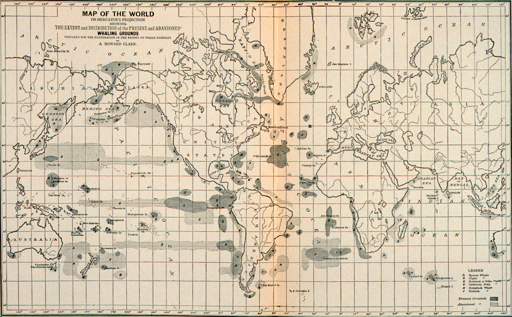
Previous WhalingSourceWhalesite Next

Plate 183   
Map of the world on Mercator's projection, showing the extent and distribution of the present and abandoned whaling grounds.
[Click on image to view in higher resolution.]

THE WHALE FISHERY.
Map of the world on Mercator's projection, showing the extent and distribution of the present and abandoned whaling grounds.

(Prepared by A. Howard Clark in 1880)

Source.
George Brown Goode.
      The fisheries and fishery industries of the United States.
Section V, History and Methods of the Fisheries ... Plates.
1887.
At head of title page: "United States Commission of Fish and Fisheries, Spencer F. Baird, Commissioner."
Also on title page: "Prepared through the cooperation of the Commissioner of Fisheries and the Superintendent of the Tenth Census by George Brown Goode, Assistant Secretary of the Smithsonian Institution and a staff of associates."
Also published as: Serial Set Vol. No. 2003, (47th Congress, 1st Session. Vol. No. 11, Misc.Doc. 124, pt. 7.)
288 p.
Maps Illustrations.

This publication may be found at HathiTrust.


Last updated by Tom Tyler, Denver, CO, USA, Dec 26 2022

Previous WhalingSourceWhalesite Next