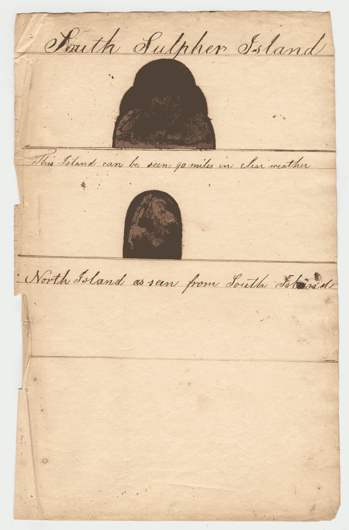
Coastal Views of North and South Sulpher Islands, 1832
by Lewis Monto.
Lewis Monto - Coastal Views of North and South Sulpher Islands, 1832.
[Click on image to view in larger format in a new window.]
Annotations:
Top: "South Sulpher Island"
"This Island can be seen 90 miles in clear weather"
Bottom: "North Island"
"as seen from South Island"
Notes:
While Lewis Monto's sketches of North and South Islands of the Sulphur Islands group in 1832 were found in his manuscript journal for the 1828-1830 whaling cruise of the Nantucket whale ship, Plough Boy, Nathan Chase, commander. Actually, the sketches were drawn by Monto on his 1830-1834 voyage when he was the third officer.
Missing from Monto's sketches is the middle and most important island of the group -- Iwo Jima. It's absence may be due to the existance at the time of William Bligh's coastal view of Iwo Jima on the admiralty chart of the islands. Bligh's drawing was made on Cook's third voyage in 1779. This chart, from which the detail below was taken, was published in 1785.
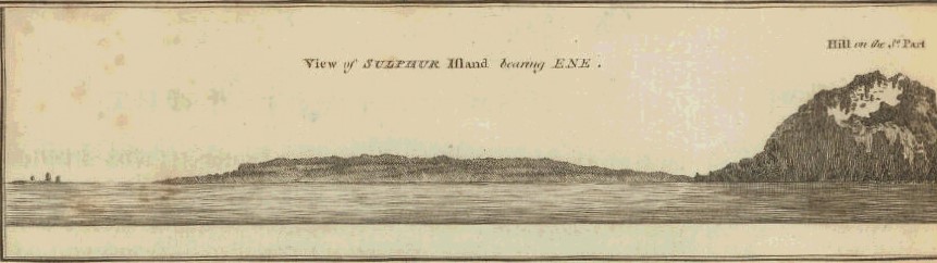
Sulphur Island - William Bligh.
[Click on image to enlarge.]
Sulphur Island is now named Iwo Jima. North Island, now named Kita Iwo Jima, was the island of San Alessandro to the Spanish. The South Island, now named Minami Iwo Jima, was San Augustino or San Dionisio to the Spanish.
The sketches are now in the collections of the Nantucket Historical Association on the island of Nantucket, Massachusetts.
Last updated by Tom Tyler, Denver, CO, USA, Aug 19, 2023.
|