Ship Plough Boy of Nantucket at the Ladrones, Sulphur and Bonin Islands in 1832.
Coastal views and journal entries from the Journal of 3d Mate, Lewis Monto.

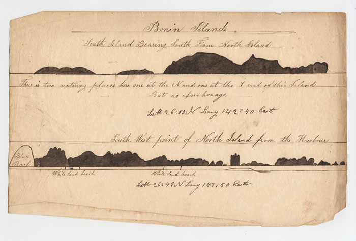
Lewis Monto's Coastal View of the Bonin Islands, 1832
Annotations:
"Bonin Islands"
[Top]
"South Island Bearing South From North Island"
"There is two watering places here one at the N and one at the S end of this Island But no Anchorage"
"Latt 26:00 N Long 142:50 East"
[Bottom]
"South West point of North Island from the Harbour"
"Latt 26:40 N Long 142:50 East"
[showing] "Bluff Rock", "White Sand beach" & "White Sand beach"
Lewis Monto's Coastal View of the Northern Bonin Islands, 1832
Lewis Monto's Coastal View of the Northern Bonin Islands, 1832, with photographs of named islands.
Professor Daniel Long of the Japanese Language and Literature Dept. at Tokyo Metropolitan University provided the photographic comparison shown above.
Comparison of Lewis Monto's Coastal View, 1832 with contemporary photographs of Hari No Iwa.
Comparison of Lewis Monto's Coastal View, 1832 with contemporary photograph of Kita no shima.
Comparison of Lewis Monto's Coastal View, 1832 with Beechey's view and contemporary photographs of Muko jima (Kater Island).
Comparison of Lewis Monto's Coastal View, 1832 with contemporary photograph of Nakoudo jima.
Comparison of Lewis Monto's Coastal View, 1832 with contemporary photograph of Yome jima.
Lewis Monto's Coastal View of the Sulpher Islands, 1832.
Annotations:
[Top]
"South Sulpher Island"
"This Island can be seen 90 miles in clear weather"
[Bottom]
"North Island as seen from South Island"
(Chart of Sulphur Island and vicinity). (with) View of Sulphur Island bearing E.N.E.
The Plough Boy may have had a copy of this 1785 chart on board when it passed through the Sulphur Islands in 1832. Perhaps given the availability of the coastal view of Sulphur Island – Lewis Monto's "Middle Island" – he saw no need in drawing it himself.
Sulphur Island is better known by its Japanese name – Iwo jima.
|