Previous Bonin Islands SourceWhalesite Next

Title page

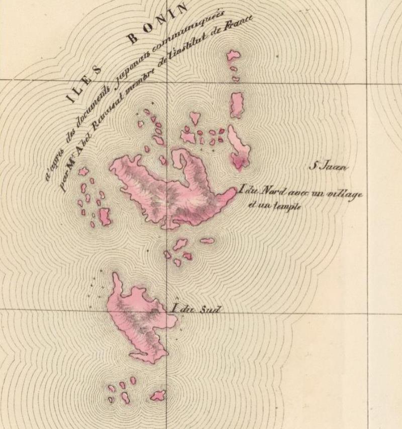
Philippe Vandermaelen's
Map of the Bonin Islands in his
Atlas universel de geographie physique, politique, statistique et mineralogique ...,
1827.

zzzz

Archipel de Magellan. Oceanie no. 1. (Dresse par Ph. Vandermaelen,
lithographie par H. Ode. Sixieme partie. - Oceanique. Bruxelles. 1827)
[Click to enlarge image]


Vandermaelen's inscribed note on the map above.

French:

      Iles Bonin: d'apres des documents japonais communiquées par Mr. Abel Remusat membre de l'institut de France

English translation:

      Bonin Islands: according to Japanese documents communicated by Mr. Abel Remusat member of the Institut de France

Source.
Philippe Vandermaelen, 1795-1869.
      Atlas universel de geographie physique, politique, statistique et mineralogique, sur l'echelle de 1/1641836 ou d'une ligne par 1900 toises ...
6e. partie. Oceanique.
Bruxelles, 1827. Archipel de Magellan. Oceanie no. 1.


The images and bibliographic notes are from the Rumsey Collection.


Last updated by Tom Tyler, Denver, CO, USA, Oct 5 2022.

Previous Bonin Islands SourceWhalesite Next