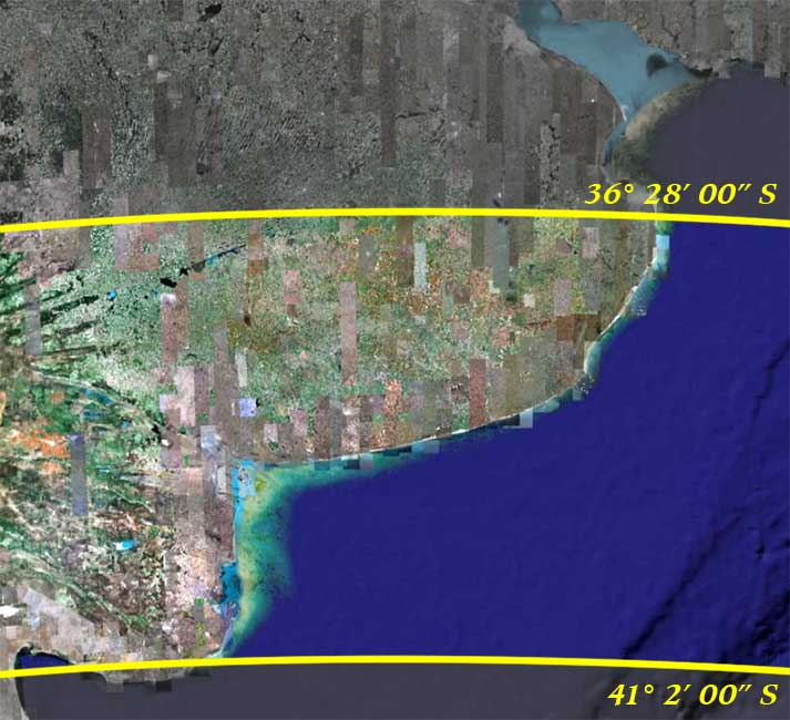


| Place Name | Lat. South | Long. West |
Argentino, Fort  [now, Bahía Blanca] § [now, Bahía Blanca] § | 38° 43' 50" | 62° 14' 41" |
Ariadne Island  —south extreme of —south extreme of | 39° 15' 50" | 62° 00' 20" |
Asunción Point  | 38° 57' 30" | 60° 38' 00" |
Black Point  —cliff summit —cliff summit | 38° 39' 00" | 58° 47' 30" |
Colorado Head  —one mile north of the entrance —one mile north of the entrance | 39° 50' 30" | 62° 05' 30" |
Colorado, Rio  —mouth —mouth | 39° 51' 40" | 62° 04' 20" |
Corrientes, Cape  —eastern summit —eastern summit | 38° 05' 30" | 57° 29' 15" |
Del Carmen, Fort  | 40° 48' 15" | 62° 58' 06" |
Gueguen, Rio  | 38° 36' 00" | 58° 40' 00" |
Hermeneg Point  | 38° 22' 40" | 57° 51' 45" |
Hermoso, Mount  —summit —summit | 38° 58' 50" | 61° 39' 45" |
Indian Head (Union Bay)  | 39° 57' 30" | 62° 07' 00" |
Labyrinth Head  —summit —summit | 39° 26' 30" | 62° 02' 36" |
Leading Hill  —summit —summit | 40° 56' 36" | 62° 49' 20" |
Mar Chiquito  —bar of —bar of | 37° 47' 30" | 57° 21' 45" |
Medanos Chato  —summit of —summit of | 36° 28' 00" | 56° 40' 15" |
Medanos Point  —south-east summit —south-east summit | 36° 59' 05" | 56° 40' 43" |
Medanos Silla  —summit of —summit of | 36° 37' 10" | 56° 40' 55" |
Mogotes Point  —south-east summit —south-east summit | 38° 10' 36" | 57° 30' 35" |
Nakedness Point  —southern summit —southern summit | 38° 49' 40" | 59° 36' 55" |
Negro, Rio  —Main Point —Main Point | 41° 2' 00" | 62° 45' 10" |
Raza Point  —summit over extreme —summit over extreme | 40° 52' 10" | 62° 18' 15" |
Rubia Point  —summit of —summit of | 40° 36' 10" | 62° 08' 40" |
San Andres Point  —south-east high cliff —south-east high cliff | 38° 17' 20" | 57° 39' 05" |
Snake Bank  —south-east extreme of —south-east extreme of | 40° 27' 00" | 61° 54' 30" |
Ventana, Mount  —highest summit —highest summit | 38° 11' 45" | 61° 56' 18" |
Wells  —Anchorstock Hill—(Point Johnson) —Anchorstock Hill—(Point Johnson) | 38° 56' 55" | 61° 58' 30" |
Zuraita Island  —south extreme of —south extreme of | 39° 11' 00" | 61° 54' 20" |
§ Today, another Fort Argentino is located about 220 miles southwest of Bahía Blanca (Google Earth coordinates -41.107470,-65.172353).